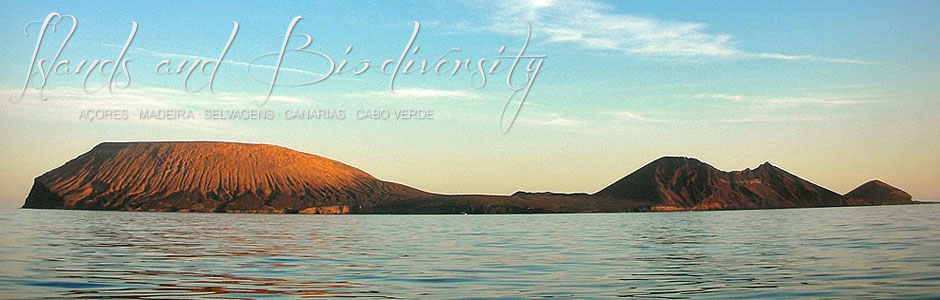
Alegranza
Alegranza (10 km2) is the northernmost point in the archipelago of the Canaries. This tiny islet is located north of Lanzarote and rises to nearly 300 m at La Caldera. It is privately owned but forms part of the Canary Islands’ Network for Protected Natural Areas; access is therefore restricted.
The island is dominated by a large caldera, considered the most intact in the archipelago. This broad edifice of around 1,300 m in diameter and 250 m deep is the result of hydrovolcanic eruptions. The west flank has been heavily eroded by the sea, leaving a great cliff and allowing a glimpse of the inner structure.
Across the central platform to the east, three volcanic cones stand in alignment and also bear the scars of sea erosion: Montaña de Lobos (220 m), Morro de las Atalayas (130 m) and Morro de la Rapadura (130 m). Lava flows from these cones cover a large area of the plateau. Several small endorheic basins containing saline clay deposits are found among malpaíses or badlands and other lesser volcanic phenomena.
In the north, an area known as El Jablillo is covered in fine white sands, hurled inland by the wind and sea.
Plant cover is characteristic of Canary Islands basal soils and halophytic vegetation is abundant. Euphorbia communities thrive spectacularly in areas buffeted by strong winds. Abandoned farmland is often covered in Aulagas, a spiny shrub, and especially wild tobacco (Nicotiana glauca), an introduced plant.
Alegranza provides shelter and a breeding ground for many bird species, including birds of prey. There are, for instance, two or three pairs of osprey (Pandian haliaetus) and the rare Eleonora’s falcon (Falco eleanarae). Seabirds are, however, the most numerous. There is a large colony of Cory’s shearwater (Calonectris diamedea), a species that was once an important part of the island economy. With 10 000 pairs, Cory’s shearwaters currently form one of the largest colonies in all Macaronesia.