
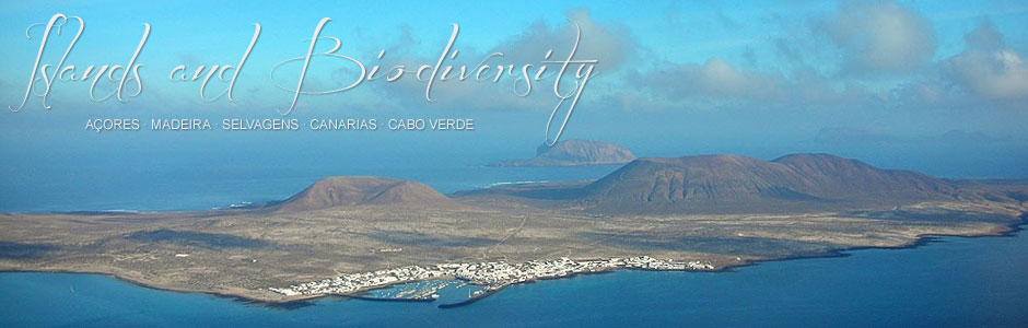
La Graciosa
La Graciosa is part of the Chinijo Nature Reserve (along with Alegranza, Montaña Clara, Roque del Este and Roque del Oeste) and stretches over 30 km2, rising to 266 m asl at Las Agujas. It is located to the northwest of Lanzarote, from which it is separated by El Río, a narrow strait just 1 km wide, with an average depth of 12 m.
Around 660 people currently live on La Graciosa in Caleta del Sebo, the only village on the island. Numbers increase considerably in summer and at holiday times, when tourists—for the most part other Canary Islanders—often stay at Pedro Barba, a former fishing hamlet now transformed into a tiny tourist spot.
The coastline is mostly low-lying and rocky, but there are several beaches of fine golden sands, such as Las Conchas, La Cocina and Los Franceses. Inland the island is covered in expanses of jable pumice, originally marine in origin. Las Agujas is the highest point, followed by El Mojón (188 m), Amarilla (172 m) and Bermeja (157 m), the latter two named for their colour—yellow and vermillion, respectively.
Vegetation on La Graciosa is characteristic of the basal soil of the eastern Canary Islands, albeit poorer, and monopolised by Aulagas (Launaea arborescens) and several species of halophytic chenopods.
Seabirds abound on the island, but other visitors include several species of steppe birds, such as the houbara bustard, cream-coloured courser and the stone curlew.