
La Palma
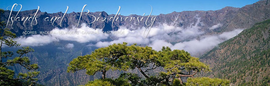
La Palma (729 km2) rises to 2,426 m at Roque de los Muchachos and is one of the most northerly and westerly of all the Canary Islands. Shaped like a triangle, its three angles end in Punta Cumplida in the northeast, Puntagorda in the northwest and Punta de Fuencaliente at the southern tip. The terrain is extremely precipitous with coastal cliffs towering above 300 m in several areas. The centre of the island features the great erosive edifice of La Caldera de Taburiente and deep ravines score various flanks. By way of contrast, the significant influence of recent and historical volcanism has created numerous low-lying lava platforms that have extended into the sea and are mainly flat or have a gentle gradient. An example is Punta de Fuencaliente, which resulted from the eruption of Teneguía volcano in 1971. The ridge of La Caldera de Taburiente features several peaks and rocky outcrops in addition to Roque de los Muchachos, such as Pico de las Nieves, Pico de la Cruz, Roque Chico and Pico Palmero, which exceed 2,200 m altitude. Moreover, in the area of Cumbre Vieja, the high points of Nambroque (1,922 m), La Deseada (1,931 m) and Montaña Negra (1,783 m) lie on a volcanic alignment that begins just south of Cumbre Nueva and extends to Fuencaliente and is one of the most important volcanic fields in all the archipelago.
La Palma has a Mediterranean climate and, unlike the other Canary Islands, the lowest average annual rainfall (below 250 mm) only occurs in a few coastal areas on the southwest flank, while the minimum rainfall for most low-lying areas is between 250 and 500 mm. The highest rainfall occurs in the forests of the north-northwest and can exceed 1,000 mm. La Palma is then the wettest Canary Island, a direct result of its northern and western location, considerable altitude and the existence of a vast wooded area of evergreen, fayal-brezal firetree and heath, and pine forests, which favour the formation of an almost permanent sea of clouds in the northern half of the island, as a consequence of the prevailing northeast trade winds. The average annual temperature is around 20º C, while minimum and maximum values are 17.8 and 22.8º C, respectively. The coldest months are January, February and March, and the warmest, August and September. As in Tenerife, snowfall and frost are common occurrences in the heights in winter and early spring.
According to the 2010 census, 86,996 people live in 14 municipalities in La Palma. The most heavily populated area is not the capital, Santa Cruz de La Palma (16,705), but Los Llanos de Aridane, with 20,895 inhabitants. Vast areas of woodland and La Caldera de Taburiente National Park mean that large sections of the island are unpopulated, although the north flank is dotted with small villages on the edges of the forests.
The island economy is partly based on tourism and the services sector, but traditional activities, such as agriculture, livestock farming and fishing, continue to dominate. The most important tourist centres are located in Los Cancajos (Breña Baja) and Puerto Naos (Los Llanos de Aridane), although a major complex has recently been completed in Fuencaliente. There is also a wide range of accommodation available in the countryside, mainly because La Palma was one of the first islands to embrace the concept of rural tourism. In fact, most visitors to the island are interested in trekking and other related sports. The network of trails in La Palma is extremely complete, as it includes all areas and all kinds of landscape, thereby making it one of the best in the Canaries. Cruise ships bring another type of tourism, mainly centred on the port of Santa Cruz de La Palma. This sector is clearly on the rise, since 183,000 cruise passengers visited the island in 2012 and forecasts for 2013 predict 213,000. The agricultural sector is extremely important and is the driving force behind the economy of most areas of the island, particularly in the north (Puntallana, San Andrés y Sauces, Barlovento and Garafía), in Valle de Aridane (El Paso, Los Llanos de Aridane and Tazacorte) and, to a certain extent, in Breña Alta, Mazo and Fuencaliente. Bananas are one of the most important crops and are harvested in many areas of the island, mostly for export. Vineyards produce quality wines with an excellent reputation abroad and fruit trees are also grown. The livestock sector is extremely important in La Palma and far more developed than in the other Canary Islands. Of the 31,841 heads, 27,651 are goats, 1,879 sheep, 1,433 cattle and 5,281 pigs. The largest pastures are located in El Paso and Mazo, though Garafía is also known for livestock farming. Fishing is based in the ports of Puerto Espíndola, Tazacorte and Santa Cruz de La Palma, but also at smaller harbours along the east and west coasts. Last but not least, local cuisine includes traditional desserts and pastries, such as almond cheese, rapaduras (a cone-shaped sweet made of honey) and bienmesabe (based on eggs, ground almonds and honey).