Santo Antão
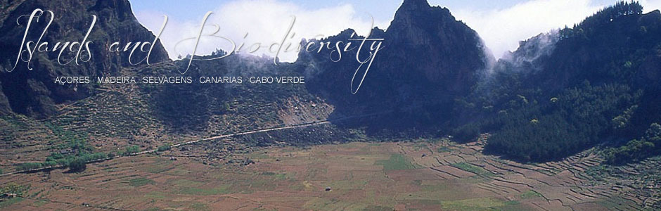
Santo Antão is at once the westernmost and northernmost island of Cape Verde, as well as being the second largest (779 km2) and second highest island (Tope da Coroa, 1979 m) in the archipelago. Ribeira Grande, the capital, is located on the north side. The terrain is extremely rugged, which makes Santo Antão one of Cape Verde’s most precipitous islands. Prominent cliffs (300 m vertical drop), deep ravines and valleys, and a chain of peaks and mountains are the main features of the landscape. However, in the south and west sectors, stretches of gently sloping terrain are mostly the result of recent volcanism—dunes largely composed of mineral (basaltic) sand deposits. Santo Antão has one of the highest rates of precipitation, with the arrival of the monsoons in summer and autumn, as well as rain fronts from the north. Moreover, the shape of the island and its position to windward in the archipelago mean that it comes under the influence of the northeast trade winds, which makes for cooler temperatures. Average annual rainfall is around 475 mm, but can be higher in north-facing areas at altitude.
The current population is 43 915 inhabitants (2010 census), spread over three municipalities: Ribeira Grande, Paul and Porto Novo. Contrary to what occurs on other islands, the population has not grown since the 1980s and numbers are slightly down since the 2000 census. The main economic activity is based around the primary sector (agriculture, fishing and stockbreeding). Sugar cane cultivation is widespread, for example in Paul, and used in the production of the local grogue, a type of aguardiente. Hence, most of the deep valleys on the northern flank are covered with this plant. Other subtropical and tropical crops are grown in the most fertile areas and include bananas and mangoes. At present, Santo Antão is the island with most water resources, thanks to a network of water channels and wells, although there is great potential for extracting fossil water through water tunnels, yet to be excavated. However, experiments with fog-catching nets have given good results in mountain regions exposed to trade winds, which can be immensely helpful for scattered populations in the area. Goats are the most important livestock, followed at a considerable distance by donkeys, sheep and mules. Despite the absence of rains in springtime, flocks of goats can be found grazing mountain pastures in springtime, as frequent fog cover provides moisture for the subsoil. Finally, fishing is important and there is a large port at Porto Novo, although boats put to sea from Ribeira Grande and other villages scattered along the north coast.
The history of Santo Antão has been shaped by food crises and the great hardships suffered by the population, which is also true for the rest of Cape Verde. There have been many critical moments, (e.g., from 1790-1791, in 1825, from 1831-1833, in 1875-1876 and in 1901-1902) when many islanders died and many others were forced to emigrate. These crises were mainly associated with periods of drought, when it was extremely difficult to sustain agriculture and water resources were scarce. Fortunately, since the 1950s the situation has improved considerably, thanks to several factors, including reforestation, water resource management and an island communication network, resulting in enhanced economic conditions for the islanders. The main wooded area of the island is Planalto Leste and in total there are around 5000 ha of forestry plantations, thanks to the climate of certain mountainous areas, which are suitable for different types of trees, including conifers, firs and Canary Island pines. The function of these plantations is very important: to prevent soil loss, replenish island aquifers and contribute to the collection of water evaporated from vegetation.
Tourism is a recent addition to the island’s main economic activities, although it is little developed at present and basically consists of hikers, nature lovers and travel enthusiasts who enjoy interacting with local people. These visitors use the existing local infrastructure at Porto Novo, Ribeira Grande, Paul and Tarrafal, which essentially falls into the rural tourism category. The fact that there is no airport (the aerodrome at Ponta do Sol is closed today) means that visitors arrive via the port at Porto Novo, which has several daily ferry connections with Mindelo, on the neighbouring island of São Vicente. In recent decades, the existence of Porto Novo port and its activities have driven considerable economic growth in the surrounding area.